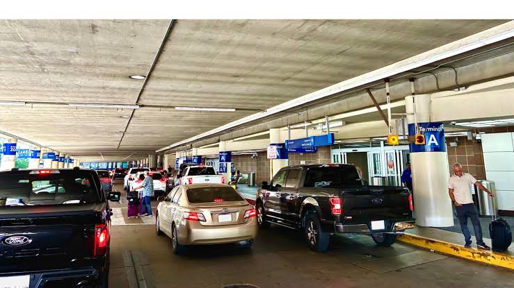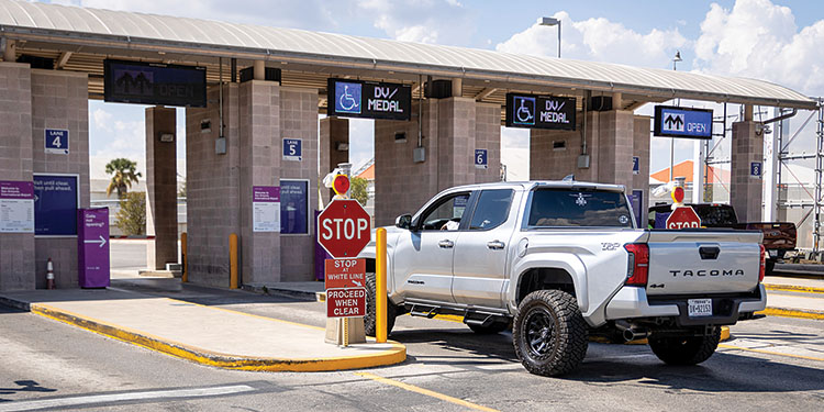

Curbside data is the record of what actually happens at the kerb: which vehicles arrive, how long they stay, how often a space turns over, and where demand outpaces supply. For most cities this information already exists. It is generated every time an enforcement vehicle drives a route or a camera observes a loading zone. The gap is not a shortage of data. The gap is visibility. When that record sits unread, parking, enforcement and mobility decisions get made on instinct, and the kerb behaves like a problem no one can quite see.
The kerb was once treated as leftover space, the strip between the footpath and the traffic lane. Today cities understand how central it is to how a place moves. Deliveries, rideshare, accessible parking, short-stay retail visits and daily commuters all compete for the same few metres. Managing that competition without evidence produces congestion, lost revenue and resident frustration. This article looks at how curbside data becomes an ally rather than a blind spot, and how cities move from guesswork to evidence using information they are frequently already collecting.

Why is the kerb so hard for cities to see clearly?
The kerb is hard to see because it changes by the hour and rarely reports on itself. A loading zone that sits empty at nine can be gridlocked by noon. A short-stay bay can turn over eight times in a morning or not at all. Traditional tools capture fragments. A manual count records one block on one day. A payment system shows who paid, not who parked. Complaint logs describe the loudest problems, not the common ones.
The result is a patchwork. Officers know the trouble spots from experience, but that knowledge lives in individual memory rather than in a shared view. Planners work from surveys that age quickly. Leadership sees revenue totals with little sense of the behaviour behind them. Each team holds a piece of the picture, and no one holds the whole. Curbside data closes that gap by making kerb behaviour continuous, comparable and shared, so the picture stops depending on who happened to be standing where.
What does it cost cities to operate the kerb in the dark?
Operating without curbside data carries a real operational cost, even when it never appears on an invoice. Congestion is the visible symptom. When a delivery van cannot find a loading bay, it double-parks, and a single blocked lane can slow a whole corridor. When drivers circle for a space, they add traffic that has nothing to do with reaching a destination and everything to do with hunting for one.
Revenue leaks in quieter ways. Bays priced or timed on assumptions rather than usage sit underused in one street and overwhelmed in the next. Enforcement effort scatters across a wide area instead of concentrating where demand and non-compliance actually cluster. Residents feel the effect as unreliable access to the spaces they were promised, and their frustration lands on the council. None of this signals a failure of effort. It signals a shortage of visibility, which is a solvable problem.
Where does the data cities need already exist?
Much of the curbside data a city wants is already being produced as a by-product of everyday operations. Every enforcement patrol is also a survey. As an officer covers a route, the vehicle passes hundreds of parked cars, loading zones and kerb spaces. That single pass observes occupancy, duration and turnover across a whole area, not just the vehicles that draw a notice.
This is the shift that changes the economics of visibility. Enforcement stops being only about compliance and becomes a way of sensing the kerb. SenSen builds on this idea. The information gathered as officers do their normal work turns into a live record of how the kerb is used. Cities do not have to instrument every block with fixed sensors to understand it. They can read the passes they are already making, which means the coverage grows with the work the team is already doing.
How does AI turn raw kerb activity into curbside data cities can use?
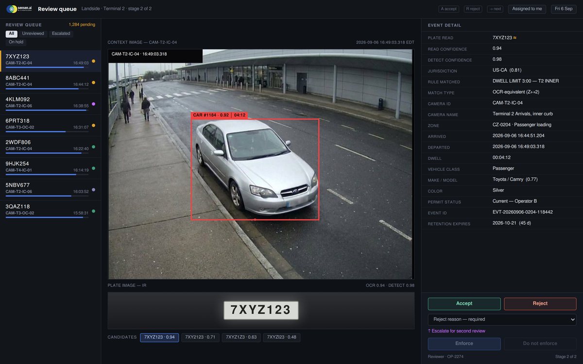
Raw observation is not the same as insight. A vehicle passing a hundred cars generates a stream of images and readings that no team could review by hand at any useful pace. This is where AI-driven analysis does the work. Computer vision reads number plates, identifies vehicle types, measures how long a vehicle stays and classifies whether it complies with the rules for that space. Disorder becomes structured curbside data, and complexity becomes something a council can read at a glance.
SenSen keeps this process human-led and private by design. Imagery is de-identified, and the platform uses no facial recognition. The output is a pattern, not a profile: occupancy across a precinct, dwell times by zone, turnover through the day, and the streets where demand and non-compliance concentrate. Officers stay in control of decisions and enforcement. The technology handles the reading and the sorting, so people spend their time acting on the picture rather than assembling it. Through a data-analytics partnership with Turnstone, that curb picture extends further into demand and behaviour analysis for cities that want it.
What decisions get sharper once curbside data is in view?
Once the kerb is visible, decisions that used to rely on instinct start to rely on evidence. Enforcement scheduling is the clearest example. When a council can see where and when non-compliance actually happens, it can direct officers to the streets and hours that matter, so the same team covers more of the problem and less of the quiet stretches. That is capacity gained, not headcount lost.
Planning improves in parallel. Curbside data shows whether a loading zone is sized for its real demand, whether a short-stay limit matches how the street is used, and where a new accessible bay would do the most good. Pricing and time limits can be set to keep spaces turning over for the people who need them, rather than held to a static rule. Leadership gets a defensible basis for the calls it makes, because the evidence sits behind every one. City intelligence built this way is not about collecting more data. It is about finally reading the data the city already holds.
How does curbside data fit into wider city intelligence?
The kerb is one surface, but the evidence it produces rarely stays contained to parking. The same vehicle passes that reveal occupancy and turnover also observe the condition of the street itself. A council reading its kerb is often close to reading its assets, its signage and the flow of traffic through a precinct. Curbside data becomes an entry point into a broader operational view rather than a single-purpose feed.
Cities across Australia and beyond are moving in this direction, and organisations such as Brisbane City Council, the City of Adelaide and Wollongong City Council reflect the same underlying pattern: kerb activity treated as a live data layer instead of an afterthought. The value compounds as departments work from one shared record rather than separate spreadsheets. Enforcement, planning and executive teams stop debating whose numbers are right and start deciding what to do. That is the quiet payoff of visibility. The argument moves from what is happening to what to do about it.
FAQ
What is curbside data?
Curbside data is the structured record of activity at the kerb: which vehicles arrive, how long they stay, how often a space turns over, and how well use matches the rules for that space. It converts everyday kerb activity into occupancy, dwell and turnover patterns a council can read and act on, rather than a stream of raw observations no team could review by hand.
Does a city need new sensors to collect curbside data?
Not necessarily. Much of the information is already generated as a by-product of routine enforcement, because every patrol pass observes far more kerb activity than the vehicles that draw a notice. Reading those passes turns existing work into a live view of the kerb, which cities can extend with additional coverage where it is most useful.
Is curbside data a privacy risk for residents?
Handled properly, no. SenSen is privacy by design: imagery is de-identified and the platform uses no facial recognition. The output is an aggregate pattern of how the kerb is used, such as occupancy and turnover, not a profile of any individual. The process stays human-led, with officers in control of enforcement decisions.
How does curbside data reduce congestion?
Congestion at the kerb is often a visibility problem. When delivery vehicles cannot find a loading bay or drivers circle for a space, they add traffic that has nothing to do with reaching a destination. Curbside data shows where demand outstrips supply, so councils can size loading zones, set time limits and direct enforcement to keep spaces turning over and lanes clear.
What can a council do with curbside data that it could not before?
A council can schedule enforcement by real demand rather than by routine, size and price kerb spaces to how they are actually used, and give leadership evidence behind every decision. Instead of managing the kerb on instinct, the team works from a shared record, so effort concentrates where it counts and access improves for the community.
SenSen helps cities turn everyday enforcement and vehicle passes into a living data layer, so the kerb becomes something you can see rather than guess at. Explore how it works across curbside enforcement, live curb awareness and city asset management, and read the kerb you are already driving past.