Road safety is shifting from something authorities react to after a crash to something they can see, measure and manage every day.
A data-driven approach to road safety means capturing how roads are actually used and what condition they are in, continuously, then giving the people who plan and maintain the network the evidence to act before harm occurs. For decades, safety work has leaned on enforcement of speed, drink and drug driving, and fatigue, supported by crash reports that arrive only after someone has been hurt. That model has saved countless lives, yet progress has stalled in many places. To move forward, the way authorities gather and use road data has to change. AI vision now makes it possible to record road-user behaviour and infrastructure condition as a by-product of routine operations, turning safety from reactive policing into proactive, data-led management.
Why is traditional road safety losing ground?
Traditional road safety is losing ground because it is largely reactive and sampled, not continuous. Crash statistics tell authorities where harm has already happened, and manual surveys capture only a snapshot of a few sites on a few days. Between those points, risk builds up unseen: a faded line at a school crossing, a pothole on a bend, a corner where vehicles and pedestrians keep coming close.
Enforcement of speed, alcohol, drugs and fatigue remains essential, but it addresses driver behaviour after risk is already present. Ambitious targets such as Vision Zero, the global goal of eliminating road deaths and serious injuries, have shown how hard progress becomes when the underlying data arrives late and in fragments. The gap is not commitment. It is visibility. Authorities cannot fix what they cannot see, and much of the network sits outside any regular measurement at all.
What does data-driven road safety actually mean?
Data-driven road safety means treating the road network as a living record that updates continuously, rather than a set of files refreshed every few years. Instead of waiting for a crash or a scheduled audit, authorities build an evidence base from how the road is used and how it is holding up, then direct attention and budget to the highest-risk locations first.
In practice this rests on two streams of evidence. The first is road-user behaviour: the movements, interactions and near-misses that reveal where the design or the environment is putting people at risk. The second is infrastructure condition: the potholes, trip hazards, worn line markings, damaged barriers and obscured signs that quietly erode safety over time. Bring both together and a council or road authority can see risk forming, not just record its consequences.
How does AI vision capture road-user behaviour and risk?
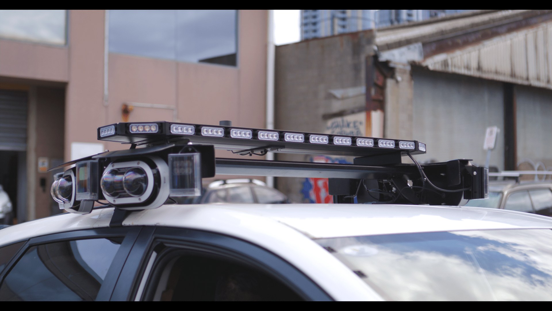
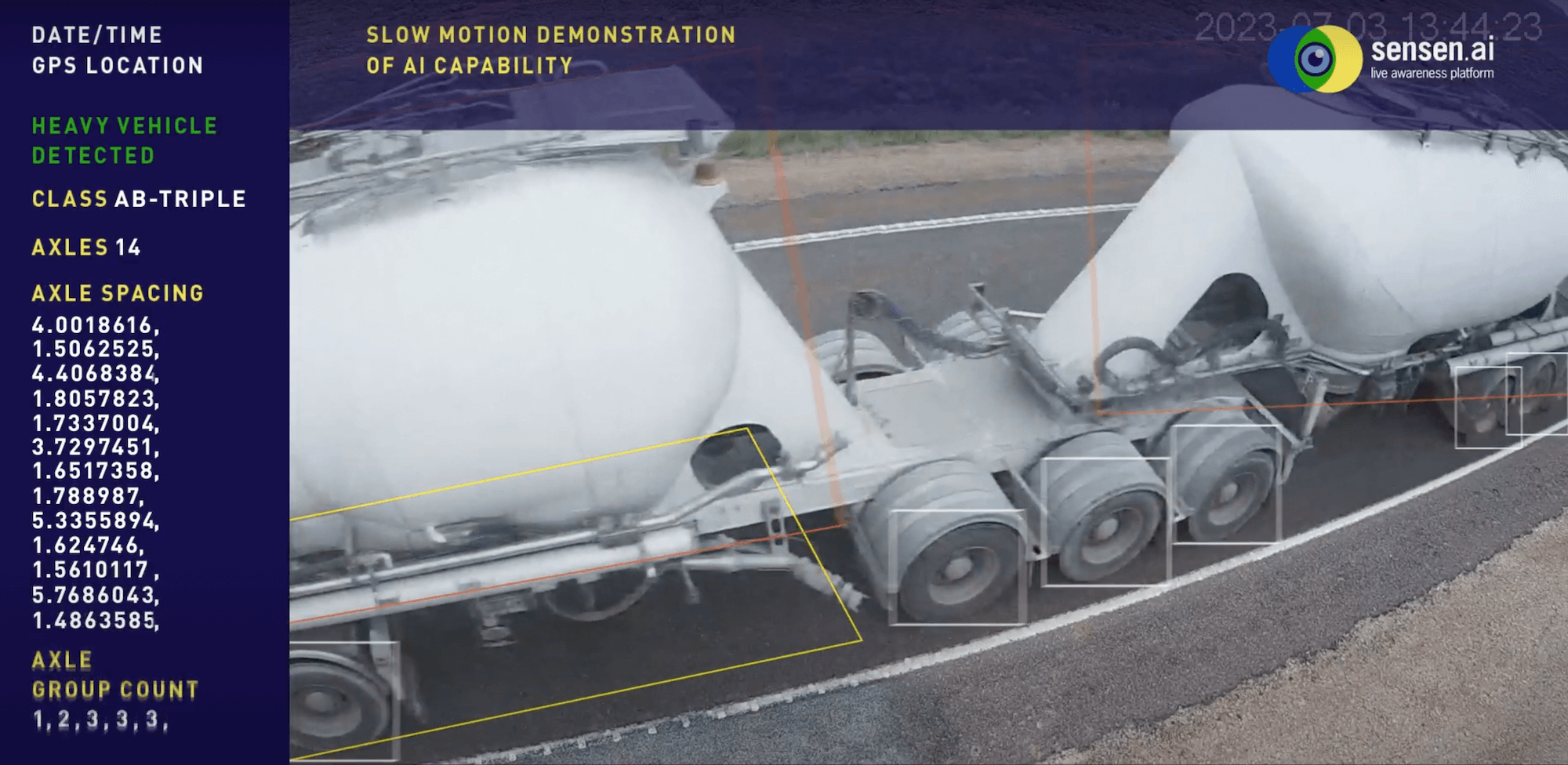
AI vision captures road-user behaviour by analysing footage from cameras that already exist across the network. SenSen applies vision analytics to everyday operations, detecting vehicles, movements, road users and near-misses from existing CCTV and vehicle-mounted cameras. The approach is camera-agnostic and privacy by design, and it uses no facial recognition. The system reads the scene, not the people in it.
Because the capture rides on vehicles and infrastructure already in service, the data accrues without dedicated survey crews or one-off studies. A patrol vehicle going about its normal round, or a fixed camera watching an intersection, becomes a sensor for how the road performs. Over time this builds a picture of where risky interactions cluster, which crossings see repeated close calls, and how patterns shift by hour, day and season. That evidence lets planners test a fix on the sites that need it most, rather than spreading effort thinly across the whole network.
How does capturing road condition prevent harm?
Capturing road condition prevents harm by finding the defects that contribute to crashes before they cause one. A pothole on a curve, a trip hazard on a pedestrian route, a broken safety barrier or a sign hidden by growth each raises risk in ways a crash report will only confirm after the fact. Seeing these early turns maintenance into a safety programme rather than a repair backlog.
SenMAP builds a GPS-accurate record of road assets and their defects from the same routine vehicle passes. It maps assets such as line markings, crossings and signs, and grades condition issues by severity, so critical faults like potholes, trip hazards, damaged barriers and faded markings rise to the top of the list. Transport for NSW used SenMAP on its “Your Streets” programme to identify more than 54,800 road defects across a 200 km network in a single mobilisation. Wollongong City Council mapped a 170 km network and detected 100% of its signs. That is the difference between guessing where the network is failing and knowing it, street by street.
Does data replace human judgement in road safety?
No. Data does not replace human judgement in road safety; it informs it. Every part of this approach is human-led. SenSen detects, evidences and surfaces what is happening on the road, and people decide what to do with it. Engineers, safety teams and elected decision-makers set the priorities, weigh the trade-offs and choose the interventions.
The value for a road authority is a stronger evidence base under those decisions. When a safety officer proposes a treatment for a dangerous crossing, they can point to recorded near-misses at that exact location. When a maintenance team plans a season of works, they can rank sites by verified condition and severity, not by whichever complaint arrived most recently. This is empowerment, not automation. It gives skilled people better information and more reach, so their judgement lands where it matters most.
How can authorities move to proactive road safety?
Authorities can move to proactive road safety by capturing behaviour and condition data continuously from operations they already run, then building their planning around that evidence. The shift does not require ripping out existing systems or standing up new survey fleets. It starts with the cameras and vehicles already on the road, and layers analytics on top.
From there the path is practical. Establish a live baseline of how the network is used and maintained. Direct attention to the highest-risk locations first, using recorded behaviour and graded condition data. Measure whether each intervention actually reduces close calls and defects, then repeat. Ambitions such as Vision Zero become far more achievable when the data behind them is current, complete and tied to specific places. A data-driven approach does not promise to end crashes on its own. It gives the people responsible for the network the visibility to keep making it safer, one fix at a time.
FAQ
What is data-driven road safety?
Data-driven road safety is an approach that captures how roads are used and what condition they are in on a continuous basis, then uses that evidence to find and fix risk before harm occurs. It shifts the focus from reacting to crashes towards managing risk proactively, with people making the decisions throughout.
Does SenSen use facial recognition for road safety?
No. SenSen uses no facial recognition. Its vision analytics are privacy by design and read the road scene, detecting vehicles, movements, road users, near-misses and infrastructure condition rather than identifying individuals.
Do authorities need new cameras to start?
Not necessarily. SenSen is camera-agnostic and works with existing CCTV and vehicle-mounted cameras. Because capture happens as a by-product of routine operations, authorities can build an evidence base without commissioning dedicated survey crews or one-off studies.
How does this support Vision Zero?
Vision Zero is the global goal of eliminating road deaths and serious injuries. A data-driven approach supports it by giving authorities current, complete evidence about behaviour and condition, so interventions can target the highest-risk locations. SenSen supports these efforts with data; the decisions remain human-led.
What kinds of road defects can be detected?
SenMAP detects and grades condition issues by severity, including potholes, trip hazards, broken safety barriers and faded line markings, alongside assets such as signs, crossings and line markings. Surfacing these early lets maintenance teams treat safety-critical faults before they contribute to a crash.
SenSen turns AI vision into a living data layer for roads and cities, capturing road-user behaviour and infrastructure condition from cameras already in service so authorities can act on risk before harm occurs. Explore how our intelligent vision agent reads the road scene, how curbside enforcement turns routine passes into evidence, and how city asset management builds a GPS-accurate record of road assets and defects. Every insight is surfaced for your team to act on, because the decisions stay with the people who know the network best.